

一、Product screenshots
1) Access of multiple satellite remote sensing data.
2) The management of multiple satellite remote sensing data.
3) The online query of image data in attribute mode and graphic mode.
4) The display of the combination of remote sensing image data and basic geographic information.
5) The distribution of multiple satellite remote sensing data.
6) Multiuser high concurrency WEB service and interaction.
1、Home Page

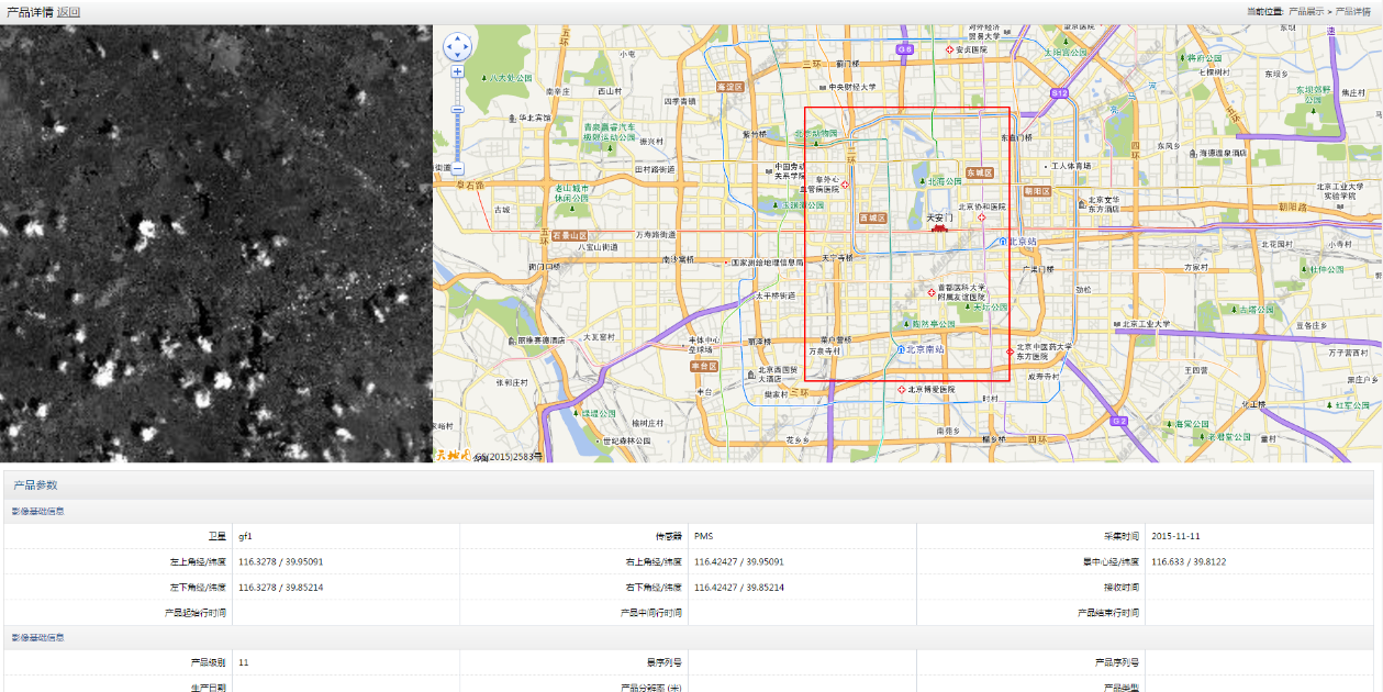
2、Product details
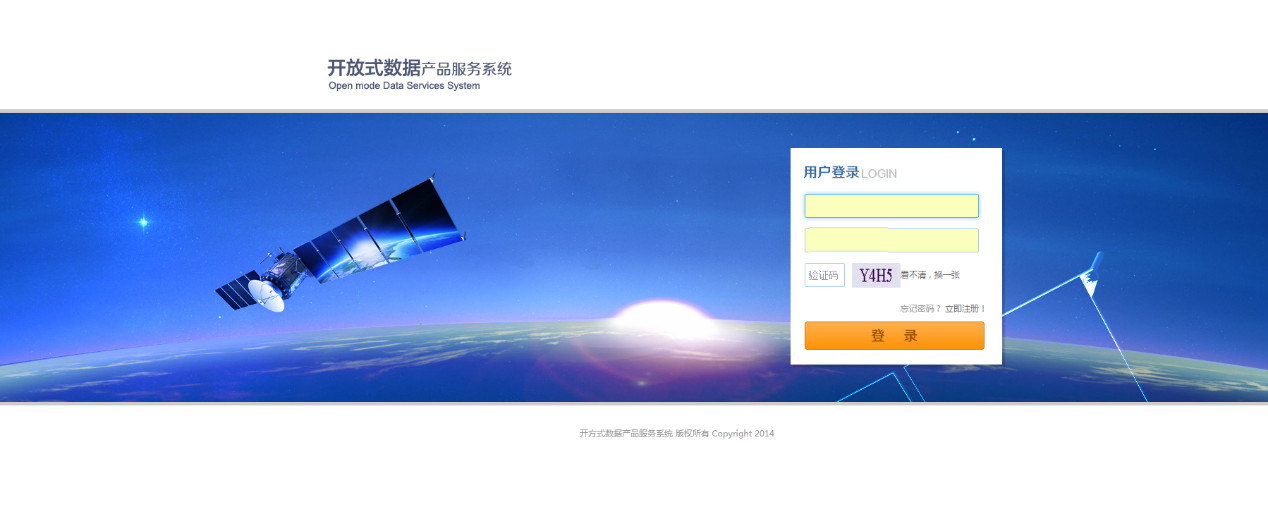
3、User login
4、Access management

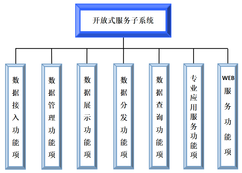
二、System architecture
1) Access of multiple satellite remote sensing data.
2) The management of multiple satellite remote sensing data.
3) The online query of image data in attribute mode and graphic mode.
4) The display of the combination of remote sensing image data and basic geographic information.
5) The distribution of multiple satellite remote sensing data.
6) Multiuser high concurrency WEB service and interaction.
四、Characteristics
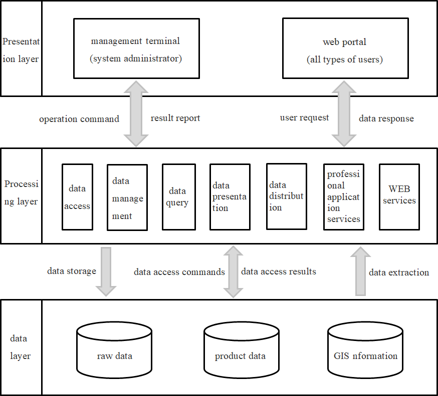
Data service systems can provide data products from different satellites. The data platform will publicly display the latest data of different time periods and different types for users.
It can be queried by the query system after the user log in. A variety of additions can be used to query the corresponding products in the data query interface, respectively including domestic, foreign, latitude and longitude, shp files and other ways. After the results are queried, the details of the data products are obtained, and the products are downloaded locally for processing and using.