
The first Venezuelan Remote Sensing Satellite (VRSS-1) launched in September 2012, is used for several domains, such as investigation, evaluation, dynamic detection and management of Venezuelan territory, resource utilization, detection of environment and disaster, and city construction as well.
VRSS-1 Satellite orbit and attitude control parameters
|
Item |
Technical Specification |
|
|
Mass |
860kg |
|
|
Size |
1532mm(Z)×1651mm(Y)×1876mm(X) |
|
|
Orbit |
Type |
SSO |
|
Altitude |
639.5km |
|
|
LTDN |
10:30 am |
|
|
Revisiting Time |
4 days |
|
|
AOCS |
Maneuver Ability |
±35° ( roll axis) |
|
Attitude Determination Accuracy |
≤0.03° |
|
VRSS-1 Specifcations of the satellite payloads
|
Type |
HR PMC |
WMC |
|
|
Spectrum |
PAN |
0.45~0.90μm |
—— |
|
MS |
0.45~0.52μm(Blue) |
0.45μm~0.52μm |
|
|
0.52~0.59μm(Green) |
0.52μm~0.59μm |
||
|
0.63~0.69μm(Red) |
0.63μm~0.69μm |
||
|
0.77~0.89μm(NIR) |
0.77μm~0.89μm |
||
|
GSD(Nadir) |
PAN |
2.5m |
16m |
|
MS |
10m |
||
|
Swath(Nadir) |
57km (2 sets) |
369km (2 sets) |
|
|
Frequency |
X band |
||
|
Capacity of Solid State Memory |
512Gbits |
||
|
Download |
190Mbps×2 |
||
|
Reliability |
5 year |
||
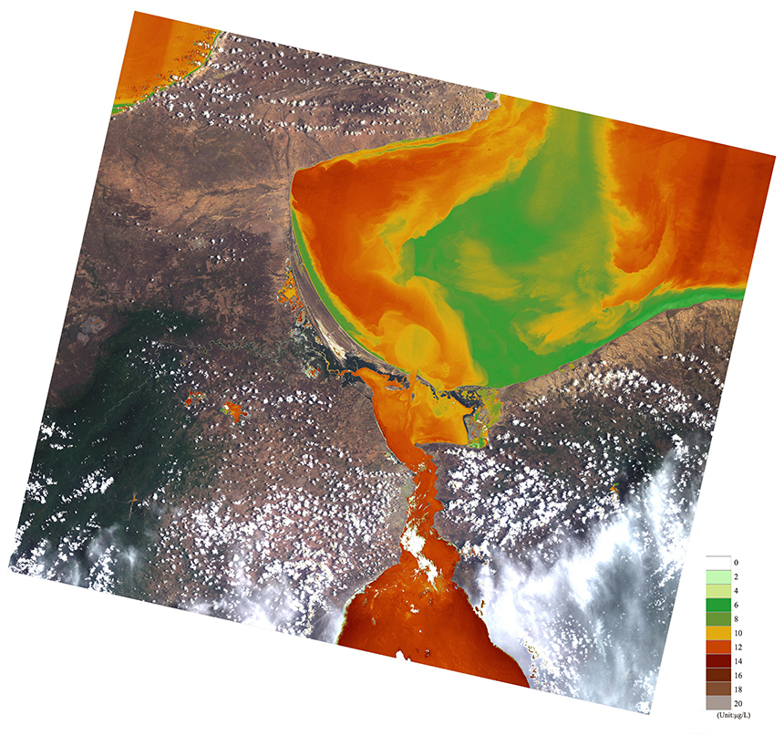
VRSS-1 Chlorophyll a1 extraction
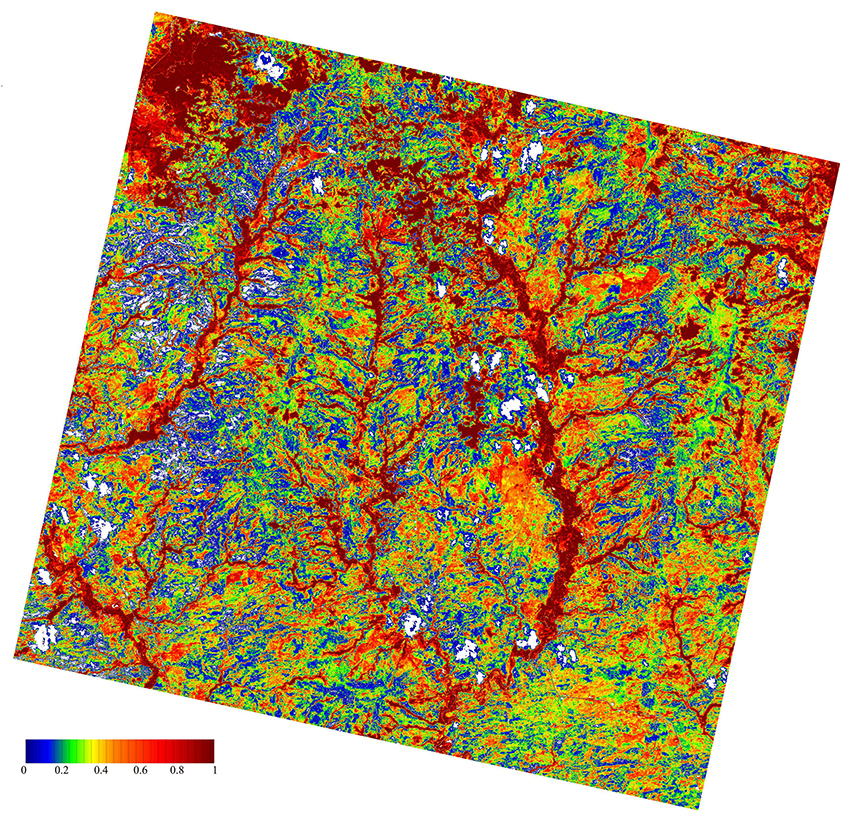
VRSS-1 Plant mulching
VRSS-1 The data are analyzed in various industries
|
Trade |
Application area |
Monitor |
|
Secure |
Public security, maritime surveillance and law enforcement |
Illegal plant planting |
|
Illegal crossings of the boundary |
||
|
Smuggling site surveillance |
||
|
Reclamation monitoring |
||
|
Floating raft culture area monitoring |
||
|
Environment |
Disasters and environmental protection |
Agricultural loss assessment |
|
International disaster reduction |
||
|
Water conservancy and supervision |
||
|
Housing damage assessment |
||
|
Urgent repair of transportation facilities |
||
| Earthquake flood prevention and control | ||
|
Sea |
Dutchman's supervision |
Dynameic surveillance of vessel |
|
Ship identification |
||
|
Monitoring of offshore oil and gas platforms |
||
|
Remote sensing |
Earth remote sensing |
City images |
|
Land image |
||
|
Road damage extraction |
||
|
Monitoring of surface soil moisture content |
||
|
Flood monitoring |
||
|
Drought disaster monitoring |
||
|
Water conservancy project monitoring |