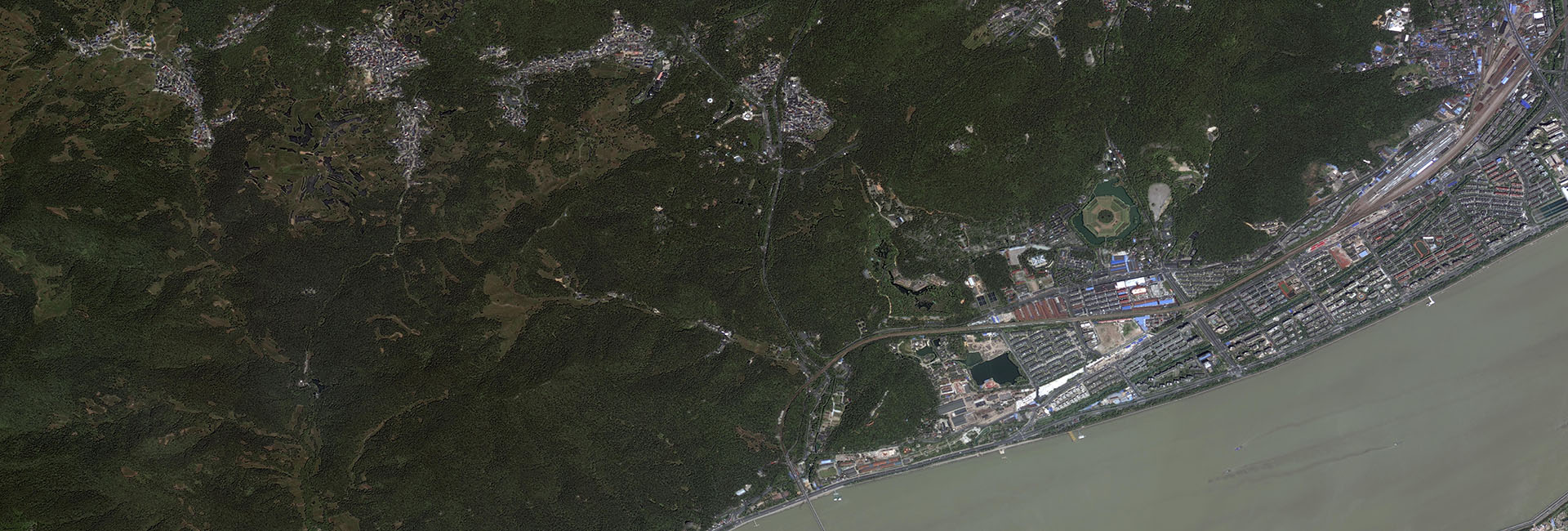

The first Venezuelan Remote Sensing Satellite (VRSS-1) launched in September 2012, is used for several domains, such as investigation, evaluation, dynamic detection and management of Venezuelan territory, resource utilization, detection of environment and disaster, and city construction as well.
VRSS-2 Satellite orbit and attitude control parameters
|
Item |
Parameters |
|
|
Mass |
980kg |
|
|
Main body dimension |
The platform module dimension is: 1562.4mm W x 1554.4mm L x 695.6mm H |
|
|
The payload module dimension is: 1562.4mm W x 1704.4mm L x 791.8mm H |
||
|
Orbit |
Type |
SSO |
|
Height |
645.693 km |
|
|
LTDN |
10:30 AM |
|
|
Revisit time |
4 day |
|
|
AOCS |
Roll maneuver ability |
Max:±35°,±20°/180s |
|
Dertmination accuracy |
≤0.01°(3σ) |
|
VRSS-2 Specifications of the satellite payloads
|
Item |
HRC |
IRC |
|
|
Spectrum Pange |
PAN |
0.50~0.80μm |
SWIR: 0.90~1.10?m(±0.05?m) 1.18~1.30?m(±0.05?m) 1.55~1.70?m(±0.05?m) |
|
MS |
0.45~0.52μm(Blue) |
||
|
0.52~0.59μm(Green) |
|||
|
0.63~0.69μm(Red) |
LWIR: 10.3~11.3?m(±0.1?m) 11.5~12.5?m(±0.1?m) |
||
| 0.77~0.89μm(NIR) | |||
|
GSD(Nadir) |
PAN |
0.98m |
SWIR: 29.7m LWIR: 59.5m |
|
MS |
2.8m |
||
|
Swath(Nadir) |
31.5km |
30.5km |
|
|
Band |
X-Band algorithm |
||
|
SSR capability |
1Tbits |
||
|
Download data rate |
450Mbps×2 |
||
|
Reliability |
5 Years |
||
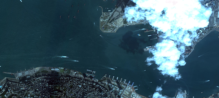
VRSS-2 Hong Kong
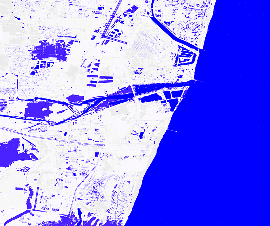
VRSS-2 Water extract
VRSS-2 The band is applied in various industries
|
Number |
Designation |
Range |
Application |
Function |
| 1 |
Blue |
v0.45~0.52μm |
Base color/scatter/coast |
It has the ability to penetrate the water body, which can help the investigation and mapping of water color, water quality, water depth and coastal water flow.It is used for forest survey to distinguish coniferous forest and broad-leaved forest, which has obvious difference to plant, water and soil reflectance, and it is easy to distinguish soil, water and plants.Analysis of land use, dry soil, vegetation characteristics, forest distribution map, determination of water depth, sediment distribution in water, mapping of offshore waters, etc. |
|
2 |
Green |
0.52~0.59μm |
Base color/coast |
The penetrating ability of the water body is strong, and it is sensitive to the reflection of vegetation. It is located between the two absorption bands of chlorophyll, and the ability to identify vegetation is enhanced by using this band, which can distinguish forest type and tree species.Sensitive to water, underwater features and blue-green ratio, soluble organics and plankton can be detected. |
|
3 |
Red |
0.63~0.69μm |
Base color/coast |
Located in chlorophyll absorption area, increases, the contrast between vegetation coverage and vegetation, according to the preparation of tonal judge plant health, can distinguish between plant species and plant coverage, can be used in geomorphology, lithology, soil, vegetation, and identification of water and sediment flow, etc. |
|
4 |
NIR |
0.77~0.89μm |
Plant/coast |
Concentrated reflection of plants strong reflection, is used in the vegetation types, biomass, survey of crop condition and crop yield estimation, draw water boundary and soil moisture, can also be used to enhance soil and crops and the contrast between land and waters. |
|
5 |
SWIR-1 |
0.90~1.10μm |
Water/plant |
There is a strong absorption of water vapor and water body, which is conducive to the identification of water bodies, delineating the boundary of water bodies and searching for shallow groundwater.Sensitive to soil and wetland, it is helpful to identify the wetland, sensitive to soil moisture content, and can identify the fourth series sediment with different water content in different periods, and the hidden water fault.Plants have strong reflectivity, a light over the image and the maximum reflectivity differences of different plants, is the best band image to distinguish the different plants, micro geomorphology is clear, is advantageous to the texture feature analysis.According to the distribution range of the fixed plants according to the color and texture features, the forest and grassland crops are distinguished, and the plant quantity and the growth potential of crops (agriculture, forestry, animal husbandry, environmental protection, etc.) are investigated. |
|
6 |
SWIR-2 |
1.18~1.30μm |
Plant |
Absorption band in the water, the water content of sensitive reaction, can be used to soil moisture and plant water content of investigation and research, water content, the analysis of crop condition, such as: used for crop growth period chlorophyll content determination and classification of plants, monitoring the condition of crop water requirement and soil moisture;It can also distinguish between clouds and snow, fresh snow and old snow, and delineate the range (agriculture, forestry, animal husbandry, environmental protection, meteorology, etc.). |
|
7 |
SWIR-3 |
1.55~1.70μm |
Plant |
|
|
8 |
LWIR-1 |
10.3~11.3μm |
Retrieving land humidity |
It belongs to thermal infrared band, is sensitive to thermal anomaly, and monitors the thermal characteristics related to human activities. It is used for thermal distribution mapping, rock identification and geological prospecting, and water temperature variation mapping. |
|
9 |
LWIR-2 |
11.5~12.5μm |
Retrieving land humidity |
The detection of high-temperature radiation sources, such as monitoring forest fires and volcanic activities, distinguishes between rock types, geological prospecting and mapping. |